Friends of Katahdin Woods & Waters Publishes Loop Road Interpretive Map
August 4, 2017
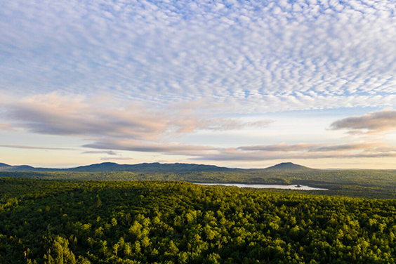
Millinocket, Maine – Friends of Katahdin Woods & Waters, the nonprofit organization founded in January to raise private funds for Maine’s new national monument, has completed its first charitable project, an interpretive map and guide to the scenic Loop Road.
“Though not yet a year old, the organization is already making donations to supplement—not replace—federal funding for Katahdin Woods and Waters National Monument,” said Lucas St. Clair, board president of Friends of Katahdin Woods & Waters. “This $5,000 project was made possible entirely through member donations. We heartily thank our charter-year donors, whose monetary contributions we are converting into tangible improvements in, and services to, the monument.”
Designed by cartographer Bill Duffy of Northern Geomantics, the 18-by-24-inch folded, full-color production has on its front side a precision topographic map showing trails, roads, rivers and other loop area features. An interpretive text and photos keyed to scenic and historic stops occupy the reverse.
Friends of Katahdin Woods & Waters board member Anita Mueller, who directed the map project, said, “With stops along the 16-mile Loop Road, the interpretive map provides context to the historical, biological, and geological significance of the Monument’s southern landscape and highlights recreation opportunities including birding, biking and hiking, all adding value to the visitor experience.”
Monument Superintendent Tim Hudson said, “The availability of the detailed description and available sights and activities on the Katahdin Loop Road will be of great assistance to the monument’s visitors and significantly increases the National Park Service’s ability to serve the public. I thank the newly formed Friends of Katahdin Woods and Waters for such a generous contribution made so early in their history.”
Don Hudson, board treasurer, said, “Friends of Katahdin Woods & Waters will make additional grants in 2017 and enlarge its giving program in 2018 and beyond.”
The Katahdin Woods and Waters National Monument Loop Road Interpretive Map is available free at the Monument’s Millinocket and Patten Visitor Contact Stations, also at Katahdin Area Chamber of Commerce and along the Loop Road. An electronic version can be viewed at https://friendsofkww.org/visitkww and on the free-for-download Discover Katahdin visitor’s app.
#
About Friends of Katahdin Woods & Waters:
The mission of Friends of Katahdin Woods and Waters is to preserve and protect the outstanding natural beauty, ecological vitality, and distinctive cultural resources of Katahdin Woods and Waters National Monument and surrounding communities for the inspiration and enjoyment of all generations.
A sixteen-member board of directors guides the nonprofit, which raises funds supporting the monument, defends it against threats, mobilizes volunteers for site projects and represents users in the betterment of monument operations.
Like Baxter State Park and Acadia National Park, Katahdin Woods and Waters National Monument sprang full-blown from private philanthropy, a word that means “love of mankind generally.” This 87,563-acre gift to the nation and Maine from the Roxanne Quimby family challenges citizens to honor and steward the natural and cultural bounty of the northern wilds. By engaging people in protecting these civic assets, Friends of Katahdin Woods & Waters works, in gratitude, to extend and magnify the tradition of selflessness and generosity that informed the monument’s creation.
To join and become involved in Friends of Katahdin Woods & Waters, visit: https://friendsofkww.org.