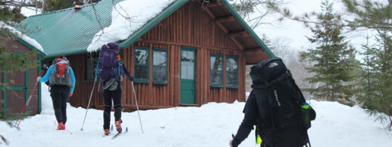
Trip Report: Seboeis River Paddle
Outside good cell service, away from wall clocks and computers, there are many ways to experience time in Katahdin Woods and Waters National Monument. Alternative time-telling questions in this neck of the woods include: Have the fiddleheads come up? Which wildflowers are growing? How are the blackflies? And one of my favorites, what’s the water level on the Seboeis?
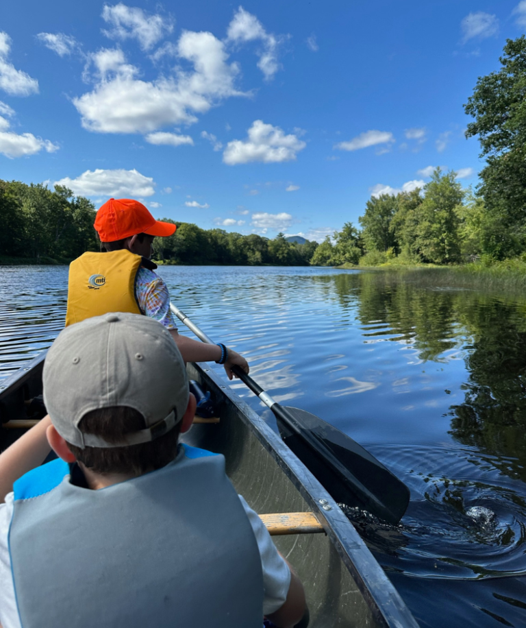
Education Coordinator Elise Goplerud, her partner Joe (an arborist and darn-good tree identifier), and I paddled the Seboeis River at around 350 cubic feet per second (“cfs”). By the Gregorian calendar, it was June 11, 2023.
350 is a good number to set your clock for (so to speak). It’s a sweet-spot for a Seboeis river trip. You can check the river levels here on the USGS website.
While we took this trip mostly for fun, we couldn’t help but think of what that 350 number means for Friends of Katahdin Woods & Waters’ in-development Three Rivers Paddling Guide. The guide recommends paddling at flows no less than 100 and no greater than 600 – though those lower flows can mean dragging your boat and the higher flows can intensify the challenge of the early rapids.

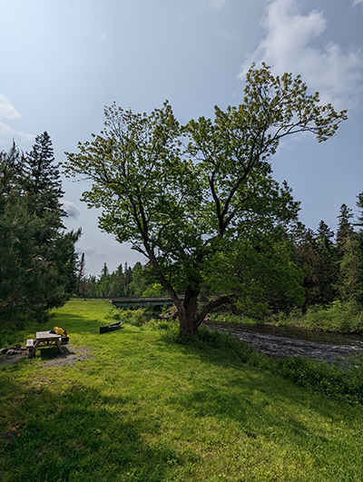
At 350 cfs, you can make a day trip of the Seboeis River from Grand Lake Rd to Lunksoos Camps, paddling around 20 miles in anywhere from four to seven hours. Make sure to leave ample time for shuttling cars and canoes. We opted to leave a car at Lunksoos Camps and bring our cars and canoes northward. In the parking lot, we met some anglers eager to drop a line for brook trout in the Seboeis’ cool pools. There are many shuttling formulations and if you want an assist, there are local lodges that will help with the back and forth.
That day, we put in around 10:30, snaking past some poison ivy (abundant on road- and river-sides) as we carried boats to the water. Putting in at Grand Lake Rd is something I’d recommend for intermediate paddlers experienced with class II rapids. Here’s why.
The water tugs you downriver from the moment you set off from the shore and it isn’t long before you’ve glided through a long stretch of rocks and rapids. The water quickens as you go, and soon you’ll need to make a swift pull-off before the crash and tumble of Grand Pitch. A large rock on river-left, and the rolling boom of water audible from the gorge below, signals it’s time for a portage. Watch out for the signage, but don’t count on it – black bears like to tear these things down. Our trio felt that given the remoteness of the trip, the repetition of rapids, and the danger of the upcoming Grand Pitch, that this first stretch qualifies as class II whitewater.

The portage is a beautiful spot to unwind from the first stretch of rapids and heavy-boat-carrying. You’re sitting at a confluence of the Davis Brook and Seboeis River, beneath the Grand Pitch and with a stunning view of Sugarloaf Mountain (not the famous ski resort – though the significant site of a fossil discovery that helped prove plate tectonics).
After the portage, there are some riffles of near-rapids, though, generally you’re settling into a flow that in all my time paddling feels so unique to the Seboeis River. It’s always pulling you gently downriver, saying something I hear like “here friend, I have something to show you.”

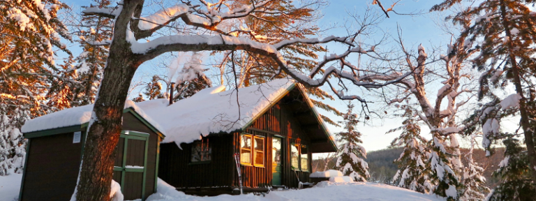
I have something to show you. One thing the river had to show this time around was the new Snowshoe Lodge, built along the Seboeis Riverside Trail to invite winter travelers to stay among a cheery woodstove and cots on a first-come, first-serve basis. Joe and Elise parked on the riverside to check it out. I pinned against some grasses until the river tugged me downriver for more fun.
I have something to show you. Tiny, tiny brooks – easier to hear than see, covered in summer brush and streaming forth from the gorge walls. Moose – crashing and clumsy through the riverside woods. Deer – bounding with their white-tails bouncing above the ferns. A bald eagle – tracking our way downriver, taking to the air and perching always a long look ahead.
I have something to show you. Not everything the river has to show was obvious to my eyes and ears, and I was grateful to have Joe and Elise as observant paddling companions. We marveled together at the trees in this river corridor – cherry, American elm, the biggest tamarack I’ve ever seen, and towering, thick pines. You’re left to wonder how they survived their many years. Does this special river feed special trees?

For paddlers wary of rapids – though eager to enjoy the Seboeis River – the Philpott Snowmobile Bridge provides an excellent put-in. Whether as a starting point or a passing landmark, I love this intersection of river and bridge. It’s a great snapshot of the Katahdin Region, a place where snowmobilers and paddlers both pass in bliss.
An important side note here: parking is a bit challenging nearby the put-in. The park service is working on it, and in the meantime, be prepared with a high-clearance four wheel drive vehicle.

It feels like the river slows down as you near the end of the Seboeis River and the confluence with the East Branch of the Penobscot. I wondered if the East Branch was full enough that it was back-filling and slowing down the Sebeois. My arms may just have been tired.
I didn’t mind slowing down because as you reach the confluence you enter the Silver Maple Floodplain. Bending, thriving, sprawling, twisting, and breaking silver maples surround you in all directions, draped over lush floodplains of ferns. Two or more trees often lean towards one another from opposing riverbanks, creating a series of arches that invite you through a gateway. Through this gateway, you’re welcomed to the widening flow of the East Branch of the Penobscot River.
As we entered the expanse of the lower East Branch, with wider vistas in sight, we could see haze on the horizon. Another indicator of time – on a larger scale than a season or year – that told us fires burned en masse to the north. I took one last picture at Lunksoos Camps, a red sun shining through the haze. While we stepped off from the East Branch, I could still feel the gentle pull of the Seboeis River.
The clock on the Seboeis said something like 300 cfs, and still I could hear Here friend, I have something to show you.

– Report submitted by Projects Director Sam Deeran. Photos contributed by Sam & Elise Goplerud.
Note: the in-development Three Rivers Paddling Guide is available for paddlers to navigate the East Branch, Seboeis, and Wassataquoik. Please reach out to Elise Goplerud at elise@friendsofkww.org for a copy. We ask paddlers trying out the map to help us ground-truth the information and send feedback after their trip. We’re also happy to provide practical advice on shaping your paddling trip.