Inspired by the National Park Service–we are excited to bring you more stories this year–Your Park Stories! Throughout 2023, we are sharing stories of meaningful place-based experiences in Katahdin Woods and Waters from the NPS, visitors, the Katahdin region, and Friends. Read on as I share my first monument camping trip as a gentle nudge to get out there yourself! Still have questions? Send me an email.
At the Upper East Branch campsite, early (but not too early) risers will be greeted by this view.
In mid-April, reservations for campsites at Katahdin Woods and Waters National Monument opened for the summer at recreation.gov. Just a couple years ago, all sites at KAWW were available “first-come-first-serve,” but having the assurance of a reservation is key to planning a trip with my husband and kids. We live in southern Maine, a solid 3.5 hour drive to the monument. I appreciate the spontaneity of the young and childless (been there) and retired empty-nesters (looking forward to it) but for now, I live a life regulated by calendars: school, sports, camp and work, digital and on paper. The ability to secure a campsite months in advance, put it in the calendars, and arrange 4 people’s individual lives around a 3-day trip is a necessity!
If you are interested in a multi-day backpacking, paddling, or cycling trip, you can do that in the monument. But this park story is about packing simply, not thinking too hard, and relaxing with family. I want folks to know that you don’t need to buy fancy gear or be an endurance athlete to find joy and connection in this remote and exceptionally beautiful place.
Easy, breezy. I booked the Upper East Branch campsite last May for a three-day trip in August. I spent about 10 minutes and precisely $8 dollars (this is the reservation fee, no matter how long your trip or which site you choose). This site is in the north end of the monument–learn more at the official KAWW site. Tip: install the NPS App before your trip and download KAWW maps for offline use while you still have a connection.
Drive right up. Despite what the sign here says, this is pure car camping. The “walk-in” refers to the fact that you must carry your gear approximately 100 feet. The kids were able to immediately run around and stretch their legs while we leisurely unpacked. Be aware that most campsites at KAWW require a much more substantial hike or paddle to access. A great option for car camping at the southern entrance: the seven tent sites at Lunksoos–including one ADA site.
Sorry, Yogi. Food goes straight from the vehicle into the giant steel storage locker. The bear box is a game-changer for keeping provisions organized–and keeps wildlife wild. Note that I recommend a big water jug, as seen here. There are NO sites at KAWW with potable water. Rather than fussing with filtering water, we always bring a big supply of drinking water.
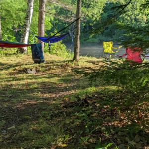
Space to spare. Here you see the distance between our two children’s tents–granting a modicum of privacy rivaling that of our 1500 square foot home. This is especially important if your children are actually teens.Pressure drop. The East Branch of the Penobscot River runs along the eastern border of the monument’s primary parcel. Hike or bike further down the Old River Road to see the rapids of Haskell Pitch, or don’t leave the campsite and enjoy the constant burbling of the quick-moving shallow water over stones. It is clear, cold, and the perfect spot to park a camp chair (yes, IN the water) on a hot day. Warm up steps away in the sunny space above the bank.
Clean, clean, clean. The national monument may lack many of the amenities of our large national parks, but the reduced traffic also means the new facilities are sparkling. This beauty was a hundred yards or so away from our campsite and accessed only by us during our stay.
Let it go. Relaxing, unplugging, and shedding the stresses of everyday life: while not ONLY possible here at this site or Katahdin Woods and Waters, the quiet and distance from other people really accelerates the process. The Upper East Branch site is buffered by literal miles from the road and the next site down the river. Here you can see me letting go of folding clothes and “making the bed.” Ahhh.
Eat well, defined by the moment. This trip, we didn’t bother with a campfire, although I am a fan of cooking hot dogs on a stick. If you DO wish to have a fire, you will need to request a fire permit in advance and purchase firewood locally. Since everything tastes better when you’re 1) outside 2) hungry from early morning dirt-road runs, I opted for the ease of just-add-hot-water at breakfast. My son turned 16 on this trip, so we drove out the 17 miles back to Mt. Chase Lodge one evening for a special meal on the lawn at Upper Shin Pond. On our last night, we grabbed a couple of whoopie pies at Matagamon Wilderness to share. (Along with a mood ring, since lost.)
Beaver pond near the Oxbow, down the road from the Upper East Branch campsite. (Your feet will get muddy here!)
Enjoy the view. Exceptional scenery can be found with modest effort along the river inside the monument and out. We climbed Horse Mountain in Baxter State Park (where the birthday boy enjoyed a few minutes of cell service), strolled to the Oxbow picnic area in the monument, and walked along the world-class Seboeis Riverside Trail to the picturesque gorge at Seboeis River Grand Pitch.
Found time. Seven hours of driving logged on a learner’s permit, a collective six books read, and 36 hours with almost no digital connection…We’ll be back again to experience that pace. And I like to think a trip like this can help us stay a bit more in the moment even at home the rest of the year.
Don’t forget to be in touch with your questions, and share Your Park Story with the #myparkstory and #katahdinwoodsandwaters. See you on the trail! -Sarah
Sarah Andre is the Development Coordinator at Friends of Katahdin Woods and Waters. She lives in Westbrook, Maine and enjoys visiting KAWW for leisure and work in all four seasons.
Brian Hinrichs Selected as Executive Director of Friends of Katahdin Woods & Waters
Today, the Friends of Katahdin Woods & Waters Board of Directors is pleased to announce the selection of Brian Hinrichs to serve as the organization’s next Executive Director.
Brian brings 15 years of non-profit management experience, most recently as the Executive Director of the Bangor Symphony Orchestra where he oversaw growth in the annual budget and reserves, operations and endowment fundraising, and community programming.
“Brian has impressed staff and board with his skillset and success as an Executive Director. Recognizing his management experience, passion for our mission, and care for relationships, we are thrilled to welcome him as the next leader of Friends of Katahdin Woods & Waters,” said Molly Ross, Chair of the Board of Directors.
On a family-favorite trail in Bangor City Forest. Credit: Alexandra Hinrichs
Brian joins Friends at a key moment in its growth. The organization has a membership of nearly 1,000 people, a collaborative network that includes dozens of organizations, a 13-person board of directors, and a seven-person full-time staff with seasonal support.
“It is an honor to be stepping into this role with Friends of Katahdin Woods & Waters at such an exciting time, and I thank the board and staff for their trust. The mission of Friends is one that resonates deeply and personally for me,” said Hinrichs.
In 2023, the organization has three priorities: completing an inaugural capital campaign, operating the youth program Katahdin Learning Project, and supporting National Park Service priorities including improved access to the national monument.
“I look forward to working alongside the National Park Service, with Wabanaki partners, and in the Katahdin Region to help ensure the monument and surrounding communities thrive for the benefit of present and future generations,” Brian continued.
Friends of Katahdin Woods & Waters is an official philanthropic partner of Katahdin Woods and Waters National Monument, part of the National Park System. The organization also partners with the National Park Service through an education agreement.
“I look forward to working with Brian and building upon the foundation that Sam Deeran and the Friends staff have established over the years,” said Mark Wimmer, Superintendent of Katahdin Woods and Waters National Monument.
While keeping his home in Bangor, Brian will frequent the Katahdin Region and work out of the Friends’ office in Patten. He will also travel across the state and elsewhere on behalf of Friends of Katahdin Woods & Waters. Brian will start his job with Friends in mid-May, taking the baton from Acting Executive Director Sam Deeran. At that time, Sam will transition to the role of Projects Director for Friends of Katahdin Woods & Waters.
Snowshoeing from the north entrance of Katahdin Woods and Waters National Monument. Credit: Brian Hinrichs
A Fulbright scholar, Brian received his B.A. in Music and English from Colgate University and his M.B.A. from the Wisconsin School of Business, UW-Madison. He has been the Executive Director of the Bangor Symphony Orchestra since 2013, where his work within its ranks, among its supporters, and in the Bangor community earned him the Bangor Region Chamber of Commerce’s Arts and Culture Award in 2022. While living and working in Bangor, Brian organized outdoor adventures throughout Maine for family and friends. His interest in Maine’s natural and cultural richness inspired him to learn more about the mission of Friends of Katahdin Woods & Waters.
Spring snow, inspiring women, vacation camp, a new ranger, and more…
March is upon us with all its charms–longer days and strong afternoon sun lures even the coziest cabin-dwellers out for fun in the soft, sticky snow. Soon snow will yield to mud, and the next season of trail stewardship and maintenance will begin. Migratory birds are navigating home, and our spring membership appeal letter will be taking flight soon as well. As you hang up your snowshoes and tuck the woolens into storage, be sure to look for a letter from Friends of Katahdin Woods and Waters arriving in your mailbox.
Paul Clifford embracing the season at Wassataquoik Lean-to during a bikepacking trip through the monument. Photo credit: Brian Threlkeld
Your OUR Park Story
For this month’s #myparkstory, the female staff at Friends are joining the National Park Service in recognizing Women’s History Month! Because conservation, science, and outdoor recreation jobs are filled mostly by men, it’s important to highlight the stories of the women who’ve inspired or mentored us. We challenge you to think about a woman who inspired your path to the outdoors, and share her story with a young person in your life.
Sarah – I found that I could make a difference in conservation and get more youth outside in nature by volunteering locally on the Presumpscot Regional Land Trust’s board. The executive director always encourages me with her words and example to stretch my leadership skills in and out of the boardroom. Rachelle, thanks for showing me it doesn’t have to be a boy’s club!
Elise- My 3rd grade teacher, Mrs. Kaplan, showed me that learning takes many shapes. We weren’t just 3rd graders- we were explorers, artists, builders and scientists. The most important lesson I learned that year was caring for our mother earth–in fact, it inspired my career today. It’s now my turn to teach the next generation empathy and compassion for this amazing planet we live on. Who knows, maybe I’ll inspire someone the way Mrs. Kaplan inspired me!
Meghan – Some of my earliest connections to nature were through the creatures that visited my family’s field and gardens and my mother’s enthusiasm in teaching me about them. Bluebirds, tree swallows, and more inhabited the birdhouses on my family’s property, and we watched generations of new birds leave their nests and fly into the big, wide world outside. Today, I cherish every interaction with the natural world, whether it’s in my own field or on a trip into the monument. My mom is still the first one I text when the snow buntings visit in the winter or when I see the first swallows (tree, barn, or cliff) of the spring!
Kala – My mom, Cindy, taught resilience by showing me that any outdoor space was a place for a walk and self-care. My grandmother, Anita, shared her love of gardening, flowers, and hard work. More recently, colleagues and mentors Julie Isbill and Susan Adams encouraged me to connect the next generation with nature here in the Katahdin region, where I have the privilege of watching students grow. I’m especially inspired by strong young women like Silvia, who encompasses kindness in all spaces, including as a volunteer with KLP!
Who are the women who nurtured your passion for conservation, outdoor education, or Katahdin Woods and Waters? Join us on social media: post your story on Facebook and Instagram with the hashtags #myparkstory and #katahdinwoodsandwaters
Elise and students exploring wildlife signs during February Vacation Camp on local trails. Photo Credit: Baileigh Studer
Vacation Camp – What are the impacts of four days of place-based education? Empathy towards living beings, a love of the outdoors, care for ourselves and each other, and stewardship of our communities and the environment. Last month, Katahdin Learning Project staff delivered the second annual February Vacation Kids Camp! This week-long program provides a safe, educational, and FUN experience for local kids at no cost during the school break. Walking through the woods was a highlight for many of the children, and at the end of the walk, they had a different perspective on wintertime. Winter is not a time to endure, but a time to enjoy. Vacation Camp is made possible through collaboration with the Katahdin Gear Library (a program of Millinocket Memorial Library) and Outdoor Sport Institute, community support, and members like you! Psst–registration for April Vacation Kids Camp will open April 3rd.
UMaine Library receives the W. Kent Olson Conservation Papers – Ken Olson, a board member from 2017 to 2019 and a charter member at Friends of Katahdin Woods & Waters, has donated his professional papers to the Fogler Library at the University of Maine. Ken’s papers span a three-decade career in conservation with time as chief executive at three nonprofits: The Nature Conservancy of Connecticut, American Rivers, and Friends of Acadia. As a leader and advocate for Friends of Acadia and Friends of Katahdin Woods & Waters, Ken has done much to foster kinship between our two Friends’ groups and parks. We thank Ken for this gift and are grateful to know his sharp writing and thinking are archived in good hands at UMaine.
Park Service News
As of the end of February, the monument has seen approximately 8,000 snowmobile visitors, with a few weeks to go! Local snowmobile clubs groom park trails, which are part of Maine’s larger Interconnected Trail System.
Katahdin Woods and Waters’ first Resource Protection Ranger, Benjamin Polloni, reported for duty on February 26th, 2023. He has been in the field and working on plans for the upcoming field season. Ranger Polloni will serve as the point of contact for commercial use authorizations and communications with law enforcement agencies in the area.
The Nature Conservancy Magazine examines the institutional and cultural barriers keeping many women from participating in or leading conservation efforts–and how we can change that.
Bookmark this Katahdin region cross-country ski round-up for next season! There is a trail network for everyone, from beginner to advanced, with your kids or your best (furry) friends. The secret of this beautiful Nordic skiing destination is out. Plan accordingly.
Sponsor Spotlight
It’s the beginning of our 2023 sponsorship year, and to kick it off, we are sharing our gratitude with two very special sponsors who make it possible for Friends to reach a statewide audience with our mission and highlight our other Katahdin, Lookout, and Deasey sponsors in print and digital ads!
Thank you to Lookout sponsors:
Would you like to see your business logo in our BDN and Down East ads this year?
Sponsors provide crucial funding that supports our mission and work. To learn more about becoming a sponsor in 2023, email sarah@friendsofkww.org
—This blog post was adapted from an email transmitted on March 20, 2023 . To sign up for our email list, please email info@friendsofkww.org—
Skiing in the monument, sponsor love, community trails, and more…
Valentine’s Day has come and gone, but all this month Friends of Katahdin Woods and Waters is sweet on a very special type of supporter: our corporate and non-profit sponsors! We’re grateful for the mission-minded businesses and organizations large and small, local and national, who care for the monument and those connected to it. We spotlight two sponsors each month (scroll to bottom)–and rely on their support all year long.
Your Park Story
Solitude and fresh snow! Photo credit: Mary Krevans
Members Mary and J.R. reached out last month for some visitation advice and happily, they were willing to share their subsequent #myparkstory with me! It’s the quintessential winter hop to the Katahdin region, especially for those suffering meager snowfall in the southern and coastal regions of Maine. Here’s their dispatch:
We drove up to Katahdin Woods and Waters on a sunny February morning. After a nice lunch at Matagamon Lodge, we parked at the north gate and enjoyed four hours of skiing on nicely packed pulk trails–without another human encounter! Just as the sky turned a pretty pink, we skied back into the parking lot. After a cozy night spent in the region (a local business graciously allowed us to park our self-contained camper van), we headed south for a second day of great skiing at Penobscot River Trails. We’ve been supporters of Friends of Katahdin Woods and Waters since the very beginning and enjoy seeing the changes as they come. Signage has improved greatly! It’s a beautiful area to visit in all seasons. -Mary and J.R. Krevans, Bar Harbor
What’s your park story? Join us on social media: post your adventures on Facebook and Instagram with the hashtags #myparkstory and #katahdinwoodsandwaters.
Executive Director Search – A thoughtful process, led by Friends’ board treasurer and Chewonki President Emeritus, Don Hudson, is well underway! Staff and board alike are excited to meet candidates in the next few weeks. In the meantime, we continue to forge ahead with our planned work for 2023 and prepare to welcome our next leader this spring.
Happy Birthday to Us! On February 28th, Friends of Katahdin Woods and Waters will turn six years old! Many of you (such as the Krevanses!) have supported us since the very beginning, and many more have joined to grow Friends into the strong organization we are today. Thank you.
Katahdin Learning Project’s February Vacation Camp – KLP is building on the success of our inaugural vacation camps last year. This February’s free weeklong camp met capacity almost immediately! Kids will munch on healthy snacks and lunch thanks to the support of Thrive Penobscot, the Northern Forest Center, Katahdin Collaborative, Elliotsville Foundation, Our Katahdin, and Yum Bakery. We are excited to foster future leaders as high school volunteers connect campers with residents at Stearns Assisted Living through a service project.
Playing on skis at camp last February
Lumbermen’s Trail – Friends is cheering together with Katahdin Area Trails and numerous nonprofit partners on the news of a $40,000 grant through Maine’s Recreational Trails Program to fund a new one-third mile trail in the gateway community of Patten. “The Lumbermen’s Trail” will begin behind the Patten Lumbermen’s Museum on town and museum-owned land. Winding through ancient conifers, hikers will find museum relics and a children’s story walk. Julie Isbill, project manager with the Rivers, Trails, and Conservation Assistance program of the National Park Service: “I love the project. It is very organic, very grassroots. We are hoping there will be a whole system in Patten. Our plan is to start with this, and eventually, we could have miles of walking trails.”
Winter camping reservations are available through recreation.gov. The bad news: Haskell Hut is fully booked through the 2023 season ending March 18th, and Big Spring Brook Hut was closed this season for necessary repairs. (The good news: subscribers to this eNewsletter will be among the first to know when summer and winter camping reservations open!)
Current job announcements from the National Park Service can be found here: nps.gov/kaww/getinvolved/workwithus Park management shared these exciting details:
Maintenance is working on hiring 8 seasonal employees and one permanent Maintenance Worker Supervisor. KAWW maintenance is hiring, for the first time, a Roads dedicated NPS crew to re-deck bridges, replace culverts, ditch, brush, mow, and gravel roads throughout the monument. Larger scale roads projects to be contracted out are two bridge replacements and one culvert. Additional work to be contracted will be brushing and ditching work on the Wassataquoik and Swift Brook Roads. NPS trail crew are to work on signage, brushing, and tread along the International Appalachian Trail (IAT) corridor. This work will be supported by the Maine Conservation Corps.
Ripple Effect
While the coast again hosts a visiting celebrity eagle, the North Maine Woods is also home to some “weird” and enviable birding–from BDN columnist and Maine Audubon Penobscot Valley Chapter vice president Bob Duchesne.
If you are already thinking about your hut visit in winter 2024, don’t miss this ready-made trip template–complete with local grub & pub recommendations!
Have you discovered the stunning Seboeis Riverside Trail yet? It is now officially open to the public with four-season recreation and rewarding views of the falls at Grand Pitch.
Sponsor Spotlight
Gratitude going out to our final spotlight sponsors from 2022! Trust for Public Land joined us at the Barnard level last year–thank you!
And thank you to Bangor Savings Bank in Millinocket for their Hathorn level sponsorship!
Gratitude, Your Park Stories, Executive Director search, and more…
As we begin a new year of monthly newsletters, we want to begin by thanking you for being a part of the Friends of Katahdin Woods and Waters family. More than 300 donations arrived in the last few weeks of the year during our annual appeal and each one makes a difference. It’s an extra special treat when a check or online donation is accompanied by a short note: “Thanks for all you do,” or “Keep up the good work!” We couldn’t say it any better ourselves, so to all who donated, volunteered, collaborated on a program, shared a post on social media, or reached out in 2022–thanks for all you do, and keep up the good work.
XC skiers on the approach to a cozy night at Haskell Hut
Inspired by the National Park Service–we are excited to bring you more stories this year–Your Park Stories! Throughout the year, we’ll be sharing stories of meaningful place-based experiences in Katahdin Woods and Waters from the NPS, visitors, the Katahdin region, and Friends. I hope you’ll join us on social media: post your adventures on Facebook and Instagram with the hashtags #MyParkStory and #KatahdinWoodsAndWaters. For this month’s #MyParkStory, Acting Executive Director Sam Deeran shares a photo essay on how Katahdin Woods and Waters National Monument inspired a big life move.
A #myparkstory photo essay by Sam Deeran
Seeking the next Friends Executive Director – The Board of Directors and staff of Friends of Katahdin Woods and Waters are pleased to announce the opening of the job of Executive Director. 2023 promises to be an exciting and important year for Friends and we look forward to welcoming a leader who will guide the organization into its next chapter. Read the full announcement on our blog–and please share!
Trust for Public Land to engage community – Have you heard? In December,Trust for Public Land, a national nonprofit that works to connect everyone to the benefits and joys of the outdoors, announced the purchase of 31,367 acres from Conservation Resources, a timber investment management organization. Over the next several years, the nonprofit will work with community leaders, outdoor advocates, public officials, and communities connected to this land to examine long-term outcomes for the property, to ensure southern access to Katahdin Woods and Waters National Monument is enhanced, and to protect trails on the property.
February Vacation Camp returns to Millinocket Memorial Library – Friends’ Katahdin Learning Project staff are excited for our second year of Vacation Camps! Offered at no cost to Katahdin region youth, the full-day program will introduce kids to outdoor skills, winter sports, and local ecology while parents work during the school break. Registration will open February 6th–keep an eye on Friends’ Facebook & Instagrampages for the link to sign up. This program is made possible with the partnership of the Millinocket Memorial Library, Outdoor Sport Institute, and many community members.
Winter recreation in the monument – The best way to explore Katahdin Woods and Waters National Monument in winter may be by foot or on skis from the north entrance. This end of the monument is open seven days a week and offers groomed trails for cross-country skiing and snowshoeing. Winter hiking, camping at Haskell Hut, ice fishing, and fat tire biking are also accessible from the north entrance. Check trail conditions here.
Did you know that snowmobile travel is allowed on approximately 22 miles of trail within the monument? Local snowmobile clubs maintain the trails under special use permits. Learn more and review all rules here before your trip.
Jobs at Katahdin Woods and Waters – The National Park Service is hiring now for seasonal maintenance workers for trails, facilities, roads, and equipment as well as Archeologist and Resource Manager. Visit nps.gov/kaww/getinvolved/workwithus for more information on how to apply!
Ripple Effect
As Friends, we strive to amplify the work of our local, regional, and national colleagues and share news from the communities of the Katahdin Region. Check it out!
Dark Skies Highlighted on Maine Public – Maine Public Radio’s Maine Calling recently presented a discussion on preserving Maine’s dark skies, featuring representatives from Dark Sky Maine and Appalachian Mountain Club and aired the film Defending the Dark (available on demand). You just may be inspired to plan a stargazing trip to see some of the darkest skies east of the Mississippi.
Patten Library Receives $3.9m – Senator Susan Collins announced that she secured $3,900,000 for the Friends of Veterans’ Memorial Library to build a new library in the omnibus funding package late last year. The library is excited to gather community input and to see how it can shape the area!
Community Snowmobile Clubs – If you sled, snowshoe, or ski onKatahdin Region snowmobile trails, consider joining or making a donation to a local club. These volunteer organizations keep the trails in good shape, maintain relationships with landowners, and bring the community together with events and fundraisers. Connect with the Northern Timber Cruisers Snowmobile Club and Museum, Twin Pines Snowmobile Club, Benedicta Snowgang, Bowlin Matagamon Shin Pond Snowmobile Club, JoMary Riders, East Branch Sno Rovers, and more by visiting the Maine Snowmobile Association. Ride safe and think snow!
Sponsor Spotlight
We’re still thanking our amazing 2022 sponsors! Thank you to Deasey level sponsor Burt’s Bees!
And thank you to Lee Auto Mall for their Barnard level sponsorship!
The Board of Directors and staff of Friends of Katahdin Woods and Waters are pleased to announce the opening of the job of Executive Director. 2023 promises to be an exciting and important year for Friends and we look forward to welcoming a leader who will guide the organization into its next chapter.
We are grateful for the opportunity to share our posting for this important position with you and encourage you to share it with those who may be interested in the job.
The Board is working with Acting Executive Director Sam Deeran to establish a new position at Friends and looks forward to working with him and the staff to ensure a smooth leadership transition. Sam shares these words: “As we make preparations to welcome a new leader, I’m looking with gratitude to the six years this organization has grown with the support of board, staff, partners, donors, vendors, and volunteers. It is these key relationships that make this work possible. You’ve made my time in this role an honor and a joy. Thank you.”
Friends staff by the East Branch of the Penobscot River – join our team!
As we move forward with the hiring process, we share these words from Don Hudson, Chair of the Search Committee: “We’re honored to play our part in important work happening here in the Katahdin Region. Relationships are at the heart of that work and so we extend this posting as an invitation to a leader who is passionate about the next chapter for these relationships and all our Friends of Katahdin Woods & Waters.”
—This blog post was adapted from an email transmitted on January 13, 2023 . To sign up for our email list, please email info@friendsofkww.org—
Last-minute holiday gift idea, hut reservations, winter fun, and more!
Greetings from Friends of Katahdin Woods and Waters. As 2022 fades and folks busy themselves with the festivities and cooking for holiday gatherings, we extend our warm wishes to you and your family. We are also looking forward to 2023, the gradual return of the light, and all the winter fun to be found in the Katahdin Region!
Haskell Hut under a blanket of snow. Photo credit: Hope Rowan
Hut reservations are open – Have you heard? Winter camping reservations are now open for Haskell Hut and Big Spring Brook Hut! These two rustic cabins are only reservable in the winter months, and they offer a remote yet cozy winter lodging experience for small groups or families that want to experience the beauty and adventures within the monument in the snowy months (January 17-March 18). Learn more and make your reservation today at recreation.gov–but be sure to read all the fine print–these huts require a substantial hike or ski to access and all food and water must be packed in. Click here to read about a staff trip to Haskell back in 2019. For the most current information about conditions (including grooming reports), visit the KAWW NPS website.
#AllInKatahdin – If you are looking for more fun in the Katahdin Region that doesn’t necessarily require trekking in on foot, check out our Katahdin Region Winter Guide, published in 2021, for the top five crowdsourced recreation activities, including snowmobiling (including certain parts of KAWW), cross-country skiing on groomed networks, and exceptional stargazing in our cold, clear skies from just about anywhere! The Katahdin Area Chamber of Commerce can help you find a home base–from luxe accommodations to simple rooms. Find even more ideas and add your favorites by searching for the hashtag #AllInKatahdin on social media!
Last minute gift idea -Uh-oh, did the holidays sneak up a little too fast? Still can’t come up with a gift for that tricky person on your list? Worry no more! You can give the gift of a Friends of Katahdin Woods and Waters membership–it’s as easy as 1,2,3.
Type “Gift membership” + recipient’s name in the Name Listing field
Print or email this image in a message to your loved one!
We’ll call or email you to gather the information we need to send a welcome packet to the new member, including our print guides, Friends decal and patch, and for gifts of $100 or more, the popular waterproof Map Adventures map!
Share your love for KAWW with a gift membership!
Sponsor Spotlight
Thank you to our Katahdin level sponsor, Richardson’s Hardware! Richardson’s has been a community fixture in Patten since 1948, and Friends is honored to have their generous annual support.
And thank you to Elliottsville Foundation, Inc for their Lookout level sponsorship! EFI is a Penobscot County-based nonprofit focused on conservation and increasing public access to outdoor recreation.
Finally, thank you to F.A. Peabody, for your 2022 Barnard level sponsorship. F.A. Peabody Insurance is there “Because…things happen.”
Annual appeal time, year-end highlights from NPS, and some inspiration…
An early fall cold snap gave way this year to an extension of the summer season. We watched the foliage blaze through October in our t-shirts and enjoyed some late season hikes after the leaves fell in mild air (but without the bugs!). A few weeks ago, the weather caught up with the calendar and a crunchy white crust settled atop the bent grasses and along the now-gated Loop Road, leaving the monument primarily to the wildlife inside and passing through by wing. In contrast, Friends staff are busy with the joyful work of wrapping up one year and preparing for the next. I know that you are busy too, so thank you for taking a moment to catch up with us
A wintry landscape on the Seboeis parcel in mid-November. Photo: Elise Goplerud
Friends annual year-end giving appeal is in full swing. Letters left the building en route to homes over the holiday weekend, inviting you to make more possible: encouraging youth to discover something new, breathing renewed energy into gateway community businesses, and improving visitor facilities within the 87,500 acres of the monument. I hope it inspires you to make your year-end gift to Friends–or you can contribute right now by visiting friendsofkww.org/donate. If you have already made your gift, thank you.
Katahdin Learning Project – Last month, we shared a little about the monument’s youngest visitors, local school children on field trips led by Friends’ Katahdin Learning Project. Kids as young as eight learned about the 13,000-year human history on this land and considered the future as community scientists looking at water quality in the east branch of the Penobscot. This important work is only possible because folks like you support these projects. We all observe changes in our environment by the day, week, month, year, and even decade. The young people engaged in place-based learning in Katahdin Woods and Waters and in their communities have the opportunity to see these changes as part of the story of the land–and decide how that story will become part of their own.
Third-grade students learn about water quality testing on a field trip to Katahdin Woods and Waters. Photo: Elise Goplerud
Friends Alliance Conference – Last month, three Friends staffers joined hundreds of our colleagues in the “friends of” community for the bi-annual gathering of the Friends Alliance in Gatlinburg, Tennessee! We hiked and saw bears at Great Smoky Mountains National Park, learned how other Friends groups engage youth and community, and shared our voices in shaping the future of park-partner relationships.
Sarah, Meghan, and Elise enjoying a mountaintop view in Gatlinburg, TN.
News from the Park – With the closing of the gates on October 31st, seasonal park staff have wrapped up for 2022 and the year-round team led by Superintendent Wimmer is busy planning for 2023! Just a few of the highlights from this year:
The Maine Conservation Corps and seasonal Park Service staff worked on improving and maintaining the International Appalachian Trail and the Wassataquoik Trailhead.
In-field mobile Ranger booths were purchased to have a place for visitors to get information as they enter the monument on the Swift Brook Road. Following a trial period, permanent booths may be established in the coming years.
In July, NPS monument staff worked with the Wabanaki Youth in Science (WaYS) group and the Maliseet Skitkomiq school camp, along with the NPS Northeast Archeological Resources Program.
NPS monument staff hosted three Tribal Historic Preservation Officers working with tribal youth and Skitkomiq schoolchildren, surveying areas in the monument by creating archeological test pits and discussed potential career opportunities for tribal youth in federal work.
A research project to better understand the amount of mercury in the waters of the monument (by testing dragonflies!) contributed to the growing knowledge of mercury impacts in the watersheds surrounding the monument and in the greater area of Maine.
From all of us at Friends, a huge thank you to our talented and dedicated park service staff. We are honored to support these ongoing projects and new work by the NPS inside the monument. Stay tuned in the months ahead for exciting infrastructure, community science, and program updates from the NPS at Katahdin Woods and Waters!
Ripple effect – As Friends here in the Katahdin Region, we strive to amplify the work of our local, regional, and national colleagues and bring news to you from Katahdin Woods and Waters and the communities connected to it.
We are feeling inspired by Great Smoky Mountains National Park Superintendent Cassius Cash speaking about his Smokies Hikes for Healing initiative.
We’re learning from The National Monument Audit, produced by Monument Lab in partnership with The Andrew W. Mellon Foundation and informing the future of telling our nation’s important stories.
Thank you to longtime sponsor L.L. Bean, supporting Friends at the Deasey level again in 2022! L.L.Bean’s regular annual support and contributions to projects like the tent sites at Lunksoos Camps are helping more people #beanoutsider!
And thank you to AMC––the Appalachian Mountain Club supports Friends’ mission with their conservation and outreach work in Maine and with their annual financial support at the Hathorn level.
Sponsors provide crucial funding that supports our mission and work. To learn more, visit friendsofkww.org/sponsorship or contact sarah@friendsofkww.org. Finally, I hope you’ll take a moment to enjoy this beautiful image taken from atop Lunksoos Mountain last fall. Thank you to our media sponsor Down East Magazine for sharing this photo and message with your print readers last month.
—This blog post was adapted from an email transmitted on December 8, 2022 . To sign up for our email list, please email info@friendsofkww.org—
Stars Over Katahdin, Katahdin Learning Project fall trips, WaYS Ancestral Lands Crew, and more…
It’s fall in Maine and while most autumn color has blown away with the wind and rain, tamarack needles are bright yellow in their late transition. For hunters and recreationists across the state, it’s time we don our orange to stay safe while hunting, hiking, biking, and more. Hunting is permitted, in accordance with Maine state law and regulations, in the monument parcels east of the East Branch of the Penobscot River. Fall is my favorite time to be in the woods, and with any luck, I’ll be stocking the freezer for the winter. However, it is especially important to be alert during this time of year, and to hunt and recreate responsibly and with gratitude for this abundant landscape.
Stars Over Katahdin – On Sept 17th this year, Stars Over Katahdin was back in person after a two-year hiatus! The event was held at Taylor’s Katahdin View Campground on the Swift Brook Rd. There was a planned hike in the monument, along with other daytime family activities. About 100 people were in attendance with more families present than ever before. This event was made possible by nearly a dozen community volunteers. We’re grateful to the volunteers and our co-presenters at Dark Sky Maine. We kept the tradition of hosting the virtual Stars event too, by co-hosting a webinar with Dark Sky Maine on Sept 22nd. You can check out a recording of the webinar here.
Katahdin Learning Project Fall Trips – This fall, the Katahdin Learning Project has been busy as ever bringing students into the monument for programs. Teachers had 4 lessons to choose from – aquatic biology, forest ecology, glacial geology or human history. Teachers gave KLP great feedback that the lessons were engaging and tied in nicely to their classroom work. Monument visits will wrap up when the gates close at the end of the month. We also wanted to share a special shout out to Coleman Haskell who joined Friends as a seasonal Place-Based Educator. Thank you to Coleman for your work, which made this fall’s program season a success!
Wabanaki Youth in Science (“WaYS”) Ancestral Lands Crew – The WaYS Ancestral Lands Crew wrapped up another great year working in Katahdin Woods and Waters National Monument and Acadia National Park. While at the monument, the crew brushed sections of the International Appalachian Trail (IAT) and improved trailheads. They also worked with Tribal Historic Preservation Officers (THPOs), and the National Park Service to learn about water ecology and archeology in the Penobscot River watershed. Crew member Logan Dana made a recap video, which you can watch here.
Bat Week – From October 24 – 31st, the National Park Service is celebrating Bat Week. Bats are critical components of the ecosystem and we love them at Katahdin Woods & Waters because one bat is capable of eating its body weight in insects each night! In 2021 & 2022, the monument has worked with partners at Dartmouth College, US Fish & Wildlife Service, Baxter State Park, and Maine Inland Fisheries & Wildlife, to better understand which bats are present in Katahdin Woods & Waters through the use of acoustic recorders. For more information about Bat Week and to learn more about how you can participate visit here.
Ripple effect – As Friends here in the Katahdin Region, we strive to amplify the work of our local, regional, and national colleagues and bring news to you from Katahdin Woods and Waters and the communities connected to it. Oct 11th of this month was Indigenous Peoples’ Day here in what we now call Maine. On social media on that day, we shared our platform with Wabanaki-led organizations around the state of Maine. To continue sharing awareness of the work and stories of Wabanaki peoples here in Maine we’re sharing resources for continued learning and engagement.
Sponsor Spotlight – Thank you to media sponsor Bangor Daily News, supporting Friends at the Lookout level in 2022! BDN takes community support seriously–in the Katahdin region and throughout Maine.
And thank you Haley Ward–a 100% employee-owned technical consulting firm–for your Deasey level sponsorship and commitment to Friends’ mission and work.
Sponsors provide crucial funding that supports our mission and work. To learn more, visit friendsofkww.org/sponsorship or contact sarah@friendsofkww.org.
—This blog post was adapted from an email transmitted on October 27, 2022 . To sign up for our email list, please email info@friendsofkww.org—
What happens when you support Friends of Katahdin Woods and Waters?
Like ripples, your support of all types and amounts spreads throughout our mission. You strengthen the connections between the national monument and the people and communities of the Katahdin region. Your gift can help show the region’s youth a future of the land with them in it, including careers in outdoor recreation and how humans and the environment can be resilient in the face of change.
Don’t take our word for it: meet Fran, a regular volunteer with the Katahdin Learning Project, a program of Friends that connects learners and land in Katahdin Woods and Waters National Monument and right in their hometowns. Through Fran’s generous volunteering and her annual membership gifts, she helps to fulfill the mission of Friends and the Katahdin Learning Project.
Born and raised in northern Maine, Fran shares the hope she felt when joining a group of seventh and eighth graders on a snowshoe hike in the monument last March.
“It is a pleasure for me to work with young people. I love helping them truly see and appreciate being outside.”
“I always learn something along with the kids. On this day, Elise [Friends’ K-12 Educator] taught us how to identify a brown ash tree in winter. The buds look like little chocolate kisses!”
To learn more about a place is to learn to love it and care for it. Field trips, vacation camps, and school visits spark a sense of place and stewardship for where these teens and children live, and may inspire students to imagine working as a park service ranger, researching invasive species, or building a business supported by a sustainable recreation economy.
“I’m so impressed with Friends’ outreach to local schools, businesses, libraries, and more–and I can see the results. It excites me to be a part of it. ”
Your support makes these special connections happen. Whether it is a dedicated volunteer, a local adolescent, or a family visiting from across the country, connections matter. Please join Fran, Katahdin region businesses, and people across Maine and the United States in the mission to preserve, protect, and promote Katahdin Woods and Waters National Monument and surrounding communities for the inspiration and enjoyment of all generations.
From all of us at Friends, we thank you for making it possible!
What’s New
Posted: April 20, 2023 by Sarah Andre
My Park Story – Car Camping at the Upper East Branch
Inspired by the National Park Service–we are excited to bring you more stories this year–Your Park Stories! Throughout 2023, we are sharing stories of meaningful place-based experiences in Katahdin Woods and Waters from the NPS, visitors, the Katahdin region, and Friends. Read on as I share my first monument camping trip as a gentle nudge to get out there yourself! Still have questions? Send me an email.
In mid-April, reservations for campsites at Katahdin Woods and Waters National Monument opened for the summer at recreation.gov. Just a couple years ago, all sites at KAWW were available “first-come-first-serve,” but having the assurance of a reservation is key to planning a trip with my husband and kids. We live in southern Maine, a solid 3.5 hour drive to the monument. I appreciate the spontaneity of the young and childless (been there) and retired empty-nesters (looking forward to it) but for now, I live a life regulated by calendars: school, sports, camp and work, digital and on paper. The ability to secure a campsite months in advance, put it in the calendars, and arrange 4 people’s individual lives around a 3-day trip is a necessity!
If you are interested in a multi-day backpacking, paddling, or cycling trip, you can do that in the monument. But this park story is about packing simply, not thinking too hard, and relaxing with family. I want folks to know that you don’t need to buy fancy gear or be an endurance athlete to find joy and connection in this remote and exceptionally beautiful place.
Easy, breezy. I booked the Upper East Branch campsite last May for a three-day trip in August. I spent about 10 minutes and precisely $8 dollars (this is the reservation fee, no matter how long your trip or which site you choose). This site is in the north end of the monument–learn more at the official KAWW site. Tip: install the NPS App before your trip and download KAWW maps for offline use while you still have a connection.
Drive right up. Despite what the sign here says, this is pure car camping. The “walk-in” refers to the fact that you must carry your gear approximately 100 feet. The kids were able to immediately run around and stretch their legs while we leisurely unpacked. Be aware that most campsites at KAWW require a much more substantial hike or paddle to access. A great option for car camping at the southern entrance: the seven tent sites at Lunksoos–including one ADA site.
Sorry, Yogi. Food goes straight from the vehicle into the giant steel storage locker. The bear box is a game-changer for keeping provisions organized–and keeps wildlife wild. Note that I recommend a big water jug, as seen here. There are NO sites at KAWW with potable water. Rather than fussing with filtering water, we always bring a big supply of drinking water.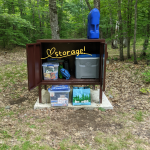
Space to spare. Here you see the distance between our two children’s tents–granting a modicum of privacy rivaling that of our 1500 square foot home. This is especially important if your children are actually teens.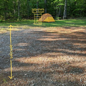 Pressure drop. The East Branch of the Penobscot River runs along the eastern border of the monument’s primary parcel. Hike or bike further down the Old River Road to see the rapids of Haskell Pitch, or don’t leave the campsite and enjoy the constant burbling of the quick-moving shallow water over stones. It is clear, cold, and the perfect spot to park a camp chair (yes, IN the water) on a hot day. Warm up steps away in the sunny space above the bank.
Clean, clean, clean. The national monument may lack many of the amenities of our large national parks, but the reduced traffic also means the new facilities are sparkling. This beauty was a hundred yards or so away from our campsite and accessed only by us during our stay.
Let it go. Relaxing, unplugging, and shedding the stresses of everyday life: while not ONLY possible here at this site or Katahdin Woods and Waters, the quiet and distance from other people really accelerates the process. The Upper East Branch site is buffered by literal miles from the road and the next site down the river. Here you can see me letting go of folding clothes and “making the bed.” Ahhh.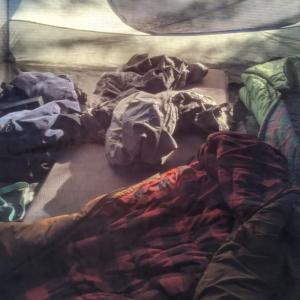
Eat well, defined by the moment. This trip, we didn’t bother with a campfire, although I am a fan of cooking hot dogs on a stick. If you DO wish to have a fire, you will need to request a fire permit in advance and purchase firewood locally. Since everything tastes better when you’re 1) outside 2) hungry from early morning dirt-road runs, I opted for the ease of just-add-hot-water at breakfast. My son turned 16 on this trip, so we drove out the 17 miles back to Mt. Chase Lodge one evening for a special meal on the lawn at Upper Shin Pond. On our last night, we grabbed a couple of whoopie pies at Matagamon Wilderness to share. (Along with a mood ring, since lost.)
Enjoy the view. Exceptional scenery can be found with modest effort along the river inside the monument and out. We climbed Horse Mountain in Baxter State Park (where the birthday boy enjoyed a few minutes of cell service), strolled to the Oxbow picnic area in the monument, and walked along the world-class Seboeis Riverside Trail to the picturesque gorge at Seboeis River Grand Pitch.
Found time. Seven hours of driving logged on a learner’s permit, a collective six books read, and 36 hours with almost no digital connection…We’ll be back again to experience that pace. And I like to think a trip like this can help us stay a bit more in the moment even at home the rest of the year.
Don’t forget to be in touch with your questions, and share Your Park Story with the #myparkstory and #katahdinwoodsandwaters. See you on the trail! -Sarah
Sarah Andre is the Development Coordinator at Friends of Katahdin Woods and Waters. She lives in Westbrook, Maine and enjoys visiting KAWW for leisure and work in all four seasons.
Posted: April 4, 2023 by Sarah Andre
Brian Hinrichs Selected as Executive Director of Friends of Katahdin Woods & Waters
Brian Hinrichs Selected as Executive Director of Friends of Katahdin Woods & Waters
Today, the Friends of Katahdin Woods & Waters Board of Directors is pleased to announce the selection of Brian Hinrichs to serve as the organization’s next Executive Director.
Brian brings 15 years of non-profit management experience, most recently as the Executive Director of the Bangor Symphony Orchestra where he oversaw growth in the annual budget and reserves, operations and endowment fundraising, and community programming.
“Brian has impressed staff and board with his skillset and success as an Executive Director. Recognizing his management experience, passion for our mission, and care for relationships, we are thrilled to welcome him as the next leader of Friends of Katahdin Woods & Waters,” said Molly Ross, Chair of the Board of Directors.
On a family-favorite trail in Bangor City Forest. Credit: Alexandra Hinrichs
Brian joins Friends at a key moment in its growth. The organization has a membership of nearly 1,000 people, a collaborative network that includes dozens of organizations, a 13-person board of directors, and a seven-person full-time staff with seasonal support.
“It is an honor to be stepping into this role with Friends of Katahdin Woods & Waters at such an exciting time, and I thank the board and staff for their trust. The mission of Friends is one that resonates deeply and personally for me,” said Hinrichs.
In 2023, the organization has three priorities: completing an inaugural capital campaign, operating the youth program Katahdin Learning Project, and supporting National Park Service priorities including improved access to the national monument.
“I look forward to working alongside the National Park Service, with Wabanaki partners, and in the Katahdin Region to help ensure the monument and surrounding communities thrive for the benefit of present and future generations,” Brian continued.
Friends of Katahdin Woods & Waters is an official philanthropic partner of Katahdin Woods and Waters National Monument, part of the National Park System. The organization also partners with the National Park Service through an education agreement.
“I look forward to working with Brian and building upon the foundation that Sam Deeran and the Friends staff have established over the years,” said Mark Wimmer, Superintendent of Katahdin Woods and Waters National Monument.
While keeping his home in Bangor, Brian will frequent the Katahdin Region and work out of the Friends’ office in Patten. He will also travel across the state and elsewhere on behalf of Friends of Katahdin Woods & Waters. Brian will start his job with Friends in mid-May, taking the baton from Acting Executive Director Sam Deeran. At that time, Sam will transition to the role of Projects Director for Friends of Katahdin Woods & Waters.
Snowshoeing from the north entrance of Katahdin Woods and Waters National Monument. Credit: Brian Hinrichs
A Fulbright scholar, Brian received his B.A. in Music and English from Colgate University and his M.B.A. from the Wisconsin School of Business, UW-Madison. He has been the Executive Director of the Bangor Symphony Orchestra since 2013, where his work within its ranks, among its supporters, and in the Bangor community earned him the Bangor Region Chamber of Commerce’s Arts and Culture Award in 2022. While living and working in Bangor, Brian organized outdoor adventures throughout Maine for family and friends. His interest in Maine’s natural and cultural richness inspired him to learn more about the mission of Friends of Katahdin Woods & Waters.
Posted: March 30, 2023 by Sarah Andre
Just around the corner – March eNewsletter
Spring snow, inspiring women, vacation camp, a new ranger, and more…
March is upon us with all its charms–longer days and strong afternoon sun lures even the coziest cabin-dwellers out for fun in the soft, sticky snow. Soon snow will yield to mud, and the next season of trail stewardship and maintenance will begin. Migratory birds are navigating home, and our spring membership appeal letter will be taking flight soon as well. As you hang up your snowshoes and tuck the woolens into storage, be sure to look for a letter from Friends of Katahdin Woods and Waters arriving in your mailbox.
YourOUR Park StoryFor this month’s #myparkstory, the female staff at Friends are joining the National Park Service in recognizing Women’s History Month! Because conservation, science, and outdoor recreation jobs are filled mostly by men, it’s important to highlight the stories of the women who’ve inspired or mentored us. We challenge you to think about a woman who inspired your path to the outdoors, and share her story with a young person in your life.
Sarah – I found that I could make a difference in conservation and get more youth outside in nature by volunteering locally on the Presumpscot Regional Land Trust’s board. The executive director always encourages me with her words and example to stretch my leadership skills in and out of the boardroom. Rachelle, thanks for showing me it doesn’t have to be a boy’s club!
Elise- My 3rd grade teacher, Mrs. Kaplan, showed me that learning takes many shapes. We weren’t just 3rd graders- we were explorers, artists, builders and scientists. The most important lesson I learned that year was caring for our mother earth–in fact, it inspired my career today. It’s now my turn to teach the next generation empathy and compassion for this amazing planet we live on. Who knows, maybe I’ll inspire someone the way Mrs. Kaplan inspired me!
Meghan – Some of my earliest connections to nature were through the creatures that visited my family’s field and gardens and my mother’s enthusiasm in teaching me about them. Bluebirds, tree swallows, and more inhabited the birdhouses on my family’s property, and we watched generations of new birds leave their nests and fly into the big, wide world outside. Today, I cherish every interaction with the natural world, whether it’s in my own field or on a trip into the monument. My mom is still the first one I text when the snow buntings visit in the winter or when I see the first swallows (tree, barn, or cliff) of the spring!
Kala – My mom, Cindy, taught resilience by showing me that any outdoor space was a place for a walk and self-care. My grandmother, Anita, shared her love of gardening, flowers, and hard work. More recently, colleagues and mentors Julie Isbill and Susan Adams encouraged me to connect the next generation with nature here in the Katahdin region, where I have the privilege of watching students grow. I’m especially inspired by strong young women like Silvia, who encompasses kindness in all spaces, including as a volunteer with KLP!
Who are the women who nurtured your passion for conservation, outdoor education, or Katahdin Woods and Waters? Join us on social media: post your story on Facebook and Instagram with the hashtags #myparkstory and #katahdinwoodsandwaters
Vacation Camp – What are the impacts of four days of place-based education? Empathy towards living beings, a love of the outdoors, care for ourselves and each other, and stewardship of our communities and the environment. Last month, Katahdin Learning Project staff delivered the second annual February Vacation Kids Camp! This week-long program provides a safe, educational, and FUN experience for local kids at no cost during the school break. Walking through the woods was a highlight for many of the children, and at the end of the walk, they had a different perspective on wintertime. Winter is not a time to endure, but a time to enjoy. Vacation Camp is made possible through collaboration with the Katahdin Gear Library (a program of Millinocket Memorial Library) and Outdoor Sport Institute, community support, and members like you! Psst–registration for April Vacation Kids Camp will open April 3rd.
UMaine Library receives the W. Kent Olson Conservation Papers – Ken Olson, a board member from 2017 to 2019 and a charter member at Friends of Katahdin Woods & Waters, has donated his professional papers to the Fogler Library at the University of Maine. Ken’s papers span a three-decade career in conservation with time as chief executive at three nonprofits: The Nature Conservancy of Connecticut, American Rivers, and Friends of Acadia. As a leader and advocate for Friends of Acadia and Friends of Katahdin Woods & Waters, Ken has done much to foster kinship between our two Friends’ groups and parks. We thank Ken for this gift and are grateful to know his sharp writing and thinking are archived in good hands at UMaine.
Park Service News
Ripple Effect
Sponsor Spotlight
It’s the beginning of our 2023 sponsorship year, and to kick it off, we are sharing our gratitude with two very special sponsors who make it possible for Friends to reach a statewide audience with our mission and highlight our other Katahdin, Lookout, and Deasey sponsors in print and digital ads!
Thank you to Lookout sponsors:
Would you like to see your business logo in our BDN and Down East ads this year?
Sponsors provide crucial funding that supports our mission and work. To learn more about becoming a sponsor in 2023, email sarah@friendsofkww.org
—This blog post was adapted from an email transmitted on March 20, 2023 . To sign up for our email list, please email info@friendsofkww.org—
Posted: March 1, 2023 by Sarah Andre
Making winter tracks – February eNewsletter
Skiing in the monument, sponsor love, community trails, and more…
Valentine’s Day has come and gone, but all this month Friends of Katahdin Woods and Waters is sweet on a very special type of supporter: our corporate and non-profit sponsors! We’re grateful for the mission-minded businesses and organizations large and small, local and national, who care for the monument and those connected to it. We spotlight two sponsors each month (scroll to bottom)–and rely on their support all year long.
Your Park Story
Members Mary and J.R. reached out last month for some visitation advice and happily, they were willing to share their subsequent #myparkstory with me! It’s the quintessential winter hop to the Katahdin region, especially for those suffering meager snowfall in the southern and coastal regions of Maine. Here’s their dispatch:
We drove up to Katahdin Woods and Waters on a sunny February morning. After a nice lunch at Matagamon Lodge, we parked at the north gate and enjoyed four hours of skiing on nicely packed pulk trails–without another human encounter! Just as the sky turned a pretty pink, we skied back into the parking lot. After a cozy night spent in the region (a local business graciously allowed us to park our self-contained camper van), we headed south for a second day of great skiing at Penobscot River Trails. We’ve been supporters of Friends of Katahdin Woods and Waters since the very beginning and enjoy seeing the changes as they come. Signage has improved greatly! It’s a beautiful area to visit in all seasons. -Mary and J.R. Krevans, Bar Harbor
What’s your park story? Join us on social media: post your adventures on Facebook and Instagram with the hashtags #myparkstory and #katahdinwoodsandwaters.
Executive Director Search – A thoughtful process, led by Friends’ board treasurer and Chewonki President Emeritus, Don Hudson, is well underway! Staff and board alike are excited to meet candidates in the next few weeks. In the meantime, we continue to forge ahead with our planned work for 2023 and prepare to welcome our next leader this spring.
Happy Birthday to Us! On February 28th, Friends of Katahdin Woods and Waters will turn six years old! Many of you (such as the Krevanses!) have supported us since the very beginning, and many more have joined to grow Friends into the strong organization we are today. Thank you.
Katahdin Learning Project’s February Vacation Camp – KLP is building on the success of our inaugural vacation camps last year. This February’s free weeklong camp met capacity almost immediately! Kids will munch on healthy snacks and lunch thanks to the support of Thrive Penobscot, the Northern Forest Center, Katahdin Collaborative, Elliotsville Foundation, Our Katahdin, and Yum Bakery. We are excited to foster future leaders as high school volunteers connect campers with residents at Stearns Assisted Living through a service project.
Lumbermen’s Trail – Friends is cheering together with Katahdin Area Trails and numerous nonprofit partners on the news of a $40,000 grant through Maine’s Recreational Trails Program to fund a new one-third mile trail in the gateway community of Patten. “The Lumbermen’s Trail” will begin behind the Patten Lumbermen’s Museum on town and museum-owned land. Winding through ancient conifers, hikers will find museum relics and a children’s story walk. Julie Isbill, project manager with the Rivers, Trails, and Conservation Assistance program of the National Park Service: “I love the project. It is very organic, very grassroots. We are hoping there will be a whole system in Patten. Our plan is to start with this, and eventually, we could have miles of walking trails.”
Park News
Maintenance is working on hiring 8 seasonal employees and one permanent Maintenance Worker Supervisor. KAWW maintenance is hiring, for the first time, a Roads dedicated NPS crew to re-deck bridges, replace culverts, ditch, brush, mow, and gravel roads throughout the monument. Larger scale roads projects to be contracted out are two bridge replacements and one culvert. Additional work to be contracted will be brushing and ditching work on the Wassataquoik and Swift Brook Roads. NPS trail crew are to work on signage, brushing, and tread along the International Appalachian Trail (IAT) corridor. This work will be supported by the Maine Conservation Corps.
Ripple Effect
Sponsor Spotlight
Gratitude going out to our final spotlight sponsors from 2022! Trust for Public Land joined us at the Barnard level last year–thank you!
And thank you to Bangor Savings Bank in Millinocket for their Hathorn level sponsorship!
Sponsors provide crucial funding that supports our mission and work. To learn more about becoming a sponsor in 2023, visit friendsofkww.org/sponsorship or contact sarah@friendsofkww.org
—This blog post was adapted from an email transmitted on February 23, 2023 . To sign up for our email list, please email info@friendsofkww.org—
Posted: February 1, 2023 by Sarah Andre
Happy New Year! January eNewsletter
Gratitude, Your Park Stories, Executive Director search, and more…
As we begin a new year of monthly newsletters, we want to begin by thanking you for being a part of the Friends of Katahdin Woods and Waters family. More than 300 donations arrived in the last few weeks of the year during our annual appeal and each one makes a difference. It’s an extra special treat when a check or online donation is accompanied by a short note: “Thanks for all you do,” or “Keep up the good work!” We couldn’t say it any better ourselves, so to all who donated, volunteered, collaborated on a program, shared a post on social media, or reached out in 2022–thanks for all you do, and keep up the good work.
Inspired by the National Park Service–we are excited to bring you more stories this year–Your Park Stories! Throughout the year, we’ll be sharing stories of meaningful place-based experiences in Katahdin Woods and Waters from the NPS, visitors, the Katahdin region, and Friends. I hope you’ll join us on social media: post your adventures on Facebook and Instagram with the hashtags #MyParkStory and #KatahdinWoodsAndWaters. For this month’s #MyParkStory, Acting Executive Director Sam Deeran shares a photo essay on how Katahdin Woods and Waters National Monument inspired a big life move.
Seeking the next Friends Executive Director – The Board of Directors and staff of Friends of Katahdin Woods and Waters are pleased to announce the opening of the job of Executive Director. 2023 promises to be an exciting and important year for Friends and we look forward to welcoming a leader who will guide the organization into its next chapter. Read the full announcement on our blog–and please share!
Trust for Public Land to engage community – Have you heard? In December,Trust for Public Land, a national nonprofit that works to connect everyone to the benefits and joys of the outdoors, announced the purchase of 31,367 acres from Conservation Resources, a timber investment management organization. Over the next several years, the nonprofit will work with community leaders, outdoor advocates, public officials, and communities connected to this land to examine long-term outcomes for the property, to ensure southern access to Katahdin Woods and Waters National Monument is enhanced, and to protect trails on the property.
February Vacation Camp returns to Millinocket Memorial Library – Friends’ Katahdin Learning Project staff are excited for our second year of Vacation Camps! Offered at no cost to Katahdin region youth, the full-day program will introduce kids to outdoor skills, winter sports, and local ecology while parents work during the school break. Registration will open February 6th–keep an eye on Friends’ Facebook & Instagram
Winter recreation in the monument – The best way to explore Katahdin Woods and Waters National Monument in winter may be by foot or on skis from the north entrance. This end of the monument is open seven days a week and offers groomed trails for cross-country skiing and snowshoeing. Winter hiking, camping at Haskell Hut, ice fishing, and fat tire biking are also accessible from the north entrance. Check trail conditions here.
Did you know that snowmobile travel is allowed on approximately 22 miles of trail within the monument? Local snowmobile clubs maintain the trails under special use permits. Learn more and review all rules here before your trip.
Jobs at Katahdin Woods and Waters – The National Park Service is hiring now for seasonal maintenance workers for trails, facilities, roads, and equipment as well as Archeologist and Resource Manager. Visit nps.gov/kaww/
Ripple Effect
As Friends, we strive to amplify the work of our local, regional, and national colleagues and share news from the communities of the Katahdin Region. Check it out!
Sponsor Spotlight
We’re still thanking our amazing 2022 sponsors! Thank you to Deasey level sponsor Burt’s Bees!
And thank you to Lee Auto Mall for their Barnard level sponsorship!
Sponsors provide crucial funding that supports our mission and work. To learn more about becoming a sponsor in 2023, visit friendsofkww.org/sponsorship or contact sarah@friendsofkww.org.
—This blog post was adapted from an email transmitted on January 30, 2023 . To sign up for our email list, please email info@friendsofkww.org—
Posted: January 13, 2023 by Sarah Andre
Announcing our search for Executive Director
The Board of Directors and staff of Friends of Katahdin Woods and Waters are pleased to announce the opening of the job of Executive Director. 2023 promises to be an exciting and important year for Friends and we look forward to welcoming a leader who will guide the organization into its next chapter.
We are grateful for the opportunity to share our posting for this important position with you and encourage you to share it with those who may be interested in the job.
The Board is working with Acting Executive Director Sam Deeran to establish a new position at Friends and looks forward to working with him and the staff to ensure a smooth leadership transition. Sam shares these words: “As we make preparations to welcome a new leader, I’m looking with gratitude to the six years this organization has grown with the support of board, staff, partners, donors, vendors, and volunteers. It is these key relationships that make this work possible. You’ve made my time in this role an honor and a joy. Thank you.”
As we move forward with the hiring process, we share these words from Don Hudson, Chair of the Search Committee: “We’re honored to play our part in important work happening here in the Katahdin Region. Relationships are at the heart of that work and so we extend this posting as an invitation to a leader who is passionate about the next chapter for these relationships and all our Friends of Katahdin Woods & Waters.”
—This blog post was adapted from an email transmitted on January 13, 2023 . To sign up for our email list, please email info@friendsofkww.org—
Posted: January 4, 2023 by Sarah Andre
Solstice and Holiday eNewsletter
Last-minute holiday gift idea, hut reservations, winter fun, and more!
Greetings from Friends of Katahdin Woods and Waters. As 2022 fades and folks busy themselves with the festivities and cooking for holiday gatherings, we extend our warm wishes to you and your family. We are also looking forward to 2023, the gradual return of the light, and all the winter fun to be found in the Katahdin Region!
Hut reservations are open – Have you heard? Winter camping reservations are now open for Haskell Hut and Big Spring Brook Hut! These two rustic cabins are only reservable in the winter months, and they offer a remote yet cozy winter lodging experience for small groups or families that want to experience the beauty and adventures within the monument in the snowy months (January 17-March 18). Learn more and make your reservation today at recreation.gov–but be sure to read all the fine print–these huts require a substantial hike or ski to access and all food and water must be packed in. Click here to read about a staff trip to Haskell back in 2019. For the most current information about conditions (including grooming reports), visit the KAWW NPS website.
#AllInKatahdin – If you are looking for more fun in the Katahdin Region that doesn’t necessarily require trekking in on foot, check out our Katahdin Region Winter Guide, published in 2021, for the top five crowdsourced recreation activities, including snowmobiling (including certain parts of KAWW), cross-country skiing on groomed networks, and exceptional stargazing in our cold, clear skies from just about anywhere! The Katahdin Area Chamber of Commerce can help you find a home base–from luxe accommodations to simple rooms. Find even more ideas and add your favorites by searching for the hashtag #AllInKatahdin on social media!
Last minute gift idea -Uh-oh, did the holidays sneak up a little too fast? Still can’t come up with a gift for that tricky person on your list? Worry no more! You can give the gift of a Friends of Katahdin Woods and Waters membership–it’s as easy as 1,2,3.
We’ll call or email you to gather the information we need to send a welcome packet to the new member, including our print guides, Friends decal and patch, and for gifts of $100 or more, the popular waterproof Map Adventures map!
Sponsor Spotlight
Thank you to our Katahdin level sponsor, Richardson’s Hardware! Richardson’s has been a community fixture in Patten since 1948, and Friends is honored to have their generous annual support.
And thank you to Elliottsville Foundation, Inc for their Lookout level sponsorship! EFI is a Penobscot County-based nonprofit focused on conservation and increasing public access to outdoor recreation.
Finally, thank you to F.A. Peabody, for your 2022 Barnard level sponsorship. F.A. Peabody Insurance is there “Because…things happen.”
Sponsors provide crucial funding that supports our mission and work. To learn more about becoming a sponsor in 2023, visit friendsofkww.org/sponsorship or contact sarah@friendsofkww.org.
—This blog post was adapted from an email transmitted on December 21, 2022 . To sign up for our email list, please email info@friendsofkww.org—
Posted: December 9, 2022 by Sarah Andre
December eNewsletter
Annual appeal time, year-end highlights from NPS, and some inspiration…
An early fall cold snap gave way this year to an extension of the summer season. We watched the foliage blaze through October in our t-shirts and enjoyed some late season hikes after the leaves fell in mild air (but without the bugs!). A few weeks ago, the weather caught up with the calendar and a crunchy white crust settled atop the bent grasses and along the now-gated Loop Road, leaving the monument primarily to the wildlife inside and passing through by wing. In contrast, Friends staff are busy with the joyful work of wrapping up one year and preparing for the next. I know that you are busy too, so thank you for taking a moment to catch up with us
A wintry landscape on the Seboeis parcel in mid-November. Photo: Elise Goplerud
Friends annual year-end giving appeal is in full swing. Letters left the building en route to homes over the holiday weekend, inviting you to make more possible: encouraging youth to discover something new, breathing renewed energy into gateway community businesses, and improving visitor facilities within the 87,500 acres of the monument. I hope it inspires you to make your year-end gift to Friends–or you can contribute right now by visiting friendsofkww.org/donate. If you have already made your gift, thank you.
Katahdin Learning Project – Last month, we shared a little about the monument’s youngest visitors, local school children on field trips led by Friends’ Katahdin Learning Project. Kids as young as eight learned about the 13,000-year human history on this land and considered the future as community scientists looking at water quality in the east branch of the Penobscot. This important work is only possible because folks like you support these projects. We all observe changes in our environment by the day, week, month, year, and even decade. The young people engaged in place-based learning in Katahdin Woods and Waters and in their communities have the opportunity to see these changes as part of the story of the land–and decide how that story will become part of their own.
Third-grade students learn about water quality testing on a field trip to Katahdin Woods and Waters. Photo: Elise Goplerud
Friends Alliance Conference – Last month, three Friends staffers joined hundreds of our colleagues in the “friends of” community for the bi-annual gathering of the Friends Alliance in Gatlinburg, Tennessee! We hiked and saw bears at Great Smoky Mountains National Park, learned how other Friends groups engage youth and community, and shared our voices in shaping the future of park-partner relationships.
Sarah, Meghan, and Elise enjoying a mountaintop view in Gatlinburg, TN.
News from the Park – With the closing of the gates on October 31st, seasonal park staff have wrapped up for 2022 and the year-round team led by Superintendent Wimmer is busy planning for 2023! Just a few of the highlights from this year:
From all of us at Friends, a huge thank you to our talented and dedicated park service staff. We are honored to support these ongoing projects and new work by the NPS inside the monument. Stay tuned in the months ahead for exciting infrastructure, community science, and program updates from the NPS at Katahdin Woods and Waters!
Ripple effect – As Friends here in the Katahdin Region, we strive to amplify the work of our local, regional, and national colleagues and bring news to you from Katahdin Woods and Waters and the communities connected to it.
Sponsor Spotlight
Thank you to longtime sponsor L.L. Bean, supporting Friends at the Deasey level again in 2022! L.L.Bean’s regular annual support and contributions to projects like the tent sites at Lunksoos Camps are helping more people #beanoutsider!
Sponsors provide crucial funding that supports our mission and work. To learn more, visit friendsofkww.org/sponsorship or contact sarah@friendsofkww.org. Finally, I hope you’ll take a moment to enjoy this beautiful image taken from atop Lunksoos Mountain last fall. Thank you to our media sponsor Down East Magazine for sharing this photo and message with your print readers last month.
—This blog post was adapted from an email transmitted on December 8, 2022 . To sign up for our email list, please email info@friendsofkww.org—
Posted: November 10, 2022 by Sarah Andre
October eNewsletter
Stars Over Katahdin, Katahdin Learning Project fall trips, WaYS Ancestral Lands Crew, and more…
It’s fall in Maine and while most autumn color has blown away with the wind and rain, tamarack needles are bright yellow in their late transition. For hunters and recreationists across the state, it’s time we don our orange to stay safe while hunting, hiking, biking, and more. Hunting is permitted, in accordance with Maine state law and regulations, in the monument parcels east of the East Branch of the Penobscot River. Fall is my favorite time to be in the woods, and with any luck, I’ll be stocking the freezer for the winter. However, it is especially important to be alert during this time of year, and to hunt and recreate responsibly and with gratitude for this abundant landscape.
Stars Over Katahdin – On Sept 17th this year, Stars Over Katahdin was back in person after a two-year hiatus! The event was held at Taylor’s Katahdin View Campground on the Swift Brook Rd. There was a planned hike in the monument, along with other daytime family activities. About 100 people were in attendance with more families present than ever before. This event was made possible by nearly a dozen community volunteers. We’re grateful to the volunteers and our co-presenters at Dark Sky Maine. We kept the tradition of hosting the virtual Stars event too, by co-hosting a webinar with Dark Sky Maine on Sept 22nd. You can check out a recording of the webinar here.
Katahdin Learning Project Fall Trips – This fall, the Katahdin Learning Project has been busy as ever bringing students into the monument for programs. Teachers had 4 lessons to choose from – aquatic biology, forest ecology, glacial geology or human history. Teachers gave KLP great feedback that the lessons were engaging and tied in nicely to their classroom work. Monument visits will wrap up when the gates close at the end of the month. We also wanted to share a special shout out to Coleman Haskell who joined Friends as a seasonal Place-Based Educator. Thank you to Coleman for your work, which made this fall’s program season a success!
Wabanaki Youth in Science (“WaYS”) Ancestral Lands Crew – The WaYS Ancestral Lands Crew wrapped up another great year working in Katahdin Woods and Waters National Monument and Acadia National Park. While at the monument, the crew brushed sections of the International Appalachian Trail (IAT) and improved trailheads. They also worked with Tribal Historic Preservation Officers (THPOs), and the National Park Service to learn about water ecology and archeology in the Penobscot River watershed. Crew member Logan Dana made a recap video, which you can watch here.
Bat Week – From October 24 – 31st, the National Park Service is celebrating Bat Week. Bats are critical components of the ecosystem and we love them at Katahdin Woods & Waters because one bat is capable of eating its body weight in insects each night! In 2021 & 2022, the monument has worked with partners at Dartmouth College, US Fish & Wildlife Service, Baxter State Park, and Maine Inland Fisheries & Wildlife, to better understand which bats are present in Katahdin Woods & Waters through the use of acoustic recorders. For more information about Bat Week and to learn more about how you can participate visit here.
Ripple effect – As Friends here in the Katahdin Region, we strive to amplify the work of our local, regional, and national colleagues and bring news to you from Katahdin Woods and Waters and the communities connected to it. Oct 11th of this month was Indigenous Peoples’ Day here in what we now call Maine. On social media on that day, we shared our platform with Wabanaki-led organizations around the state of Maine. To continue sharing awareness of the work and stories of Wabanaki peoples here in Maine we’re sharing resources for continued learning and engagement.
Sponsor Spotlight – Thank you to media sponsor Bangor Daily News, supporting Friends at the Lookout level in 2022! BDN takes community support seriously–in the Katahdin region and throughout Maine.
And thank you Haley Ward–a 100% employee-owned technical consulting firm–for your Deasey level sponsorship and commitment to Friends’ mission and work.
Sponsors provide crucial funding that supports our mission and work. To learn more, visit friendsofkww.org/sponsorship or contact sarah@friendsofkww.org.
—This blog post was adapted from an email transmitted on October 27, 2022 . To sign up for our email list, please email info@friendsofkww.org—
Posted: October 21, 2022 by Sarah Andre
What your gift can do
What happens when you support Friends of Katahdin Woods and Waters?
Like ripples, your support of all types and amounts spreads throughout our mission. You strengthen the connections between the national monument and the people and communities of the Katahdin region. Your gift can help show the region’s youth a future of the land with them in it, including careers in outdoor recreation and how humans and the environment can be resilient in the face of change.
Make your annual gift or become a Friend today. Your gift will keep our programs growing!
Don’t take our word for it: meet Fran, a regular volunteer with the Katahdin Learning Project, a program of Friends that connects learners and land in Katahdin Woods and Waters National Monument and right in their hometowns. Through Fran’s generous volunteering and her annual membership gifts, she helps to fulfill the mission of Friends and the Katahdin Learning Project.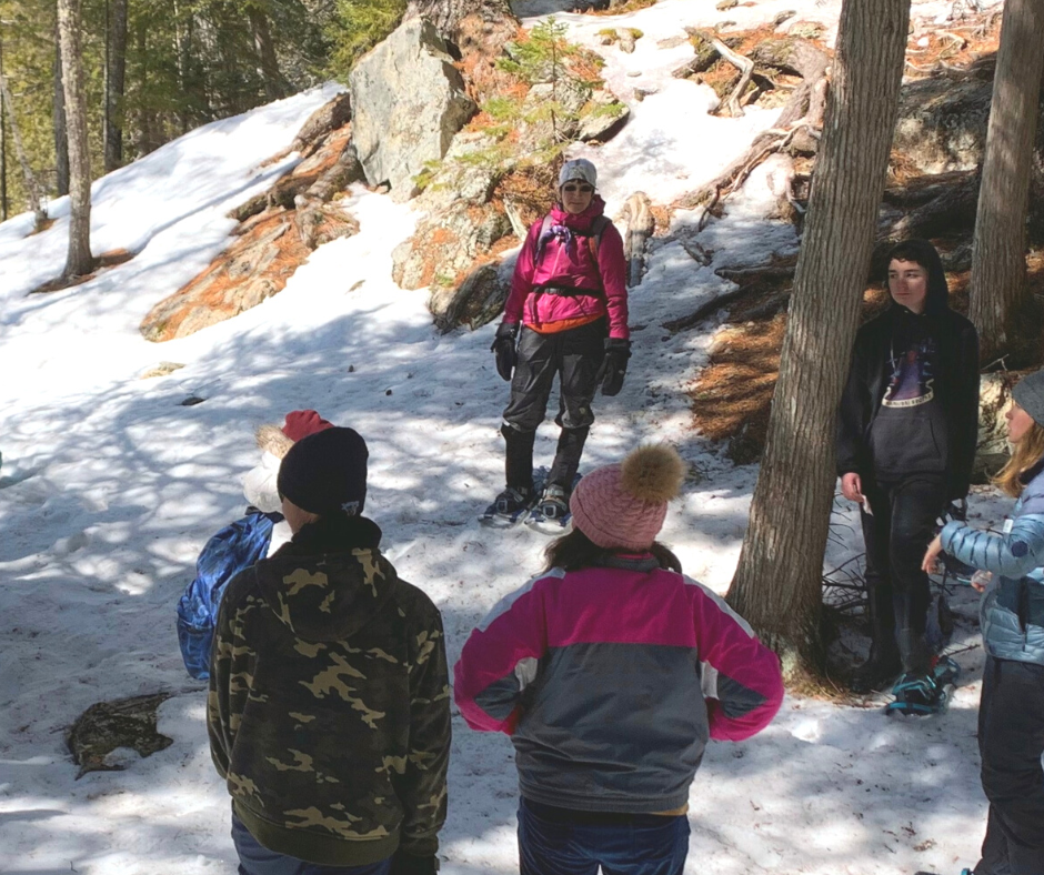
Born and raised in northern Maine, Fran shares the hope she felt when joining a group of seventh and eighth graders on a snowshoe hike in the monument last March.
Save a stamp: make your gift by Friday, October and we will remove your name from our annual appeal mailing list.
Or
Save time and peace of mind while providing regular support with a recurring monthly gift.
To learn more about a place is to learn to love it and care for it. Field trips, vacation camps, and school visits spark a sense of place and stewardship for where these teens and children live, and may inspire students to imagine working as a park service ranger, researching invasive species, or building a business supported by a sustainable recreation economy.
Your support makes these special connections happen. Whether it is a dedicated volunteer, a local adolescent, or a family visiting from across the country, connections matter. Please join Fran, Katahdin region businesses, and people across Maine and the United States in the mission to preserve, protect, and promote Katahdin Woods and Waters National Monument and surrounding communities for the inspiration and enjoyment of all generations.
From all of us at Friends, we thank you for making it possible!
PS: Don’t delay–click here to make your gift and it will go right to work to engage more students and community members!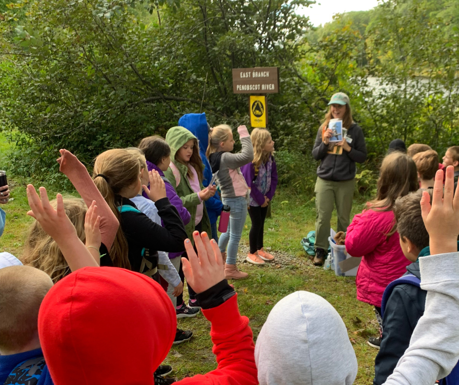
—This blog post was adapted from an email transmitted on October 19, 2022. To sign up for our email list, please email info@friendsofkww.org—